.png?width=375&height=100&name=WebPage%20logo%20with%20curves%202026%20(8).png)
Texas Science Teacher Resource Hub
Free scope and sequences, TEKS breakdowns, phenomenon ideas, and engagement activities for the 2024 Texas science standards.

🚀 Jump to Your Grade
Pick your grade level and go straight to your TEKS standards, aligned resources, and teaching tools.
-
4th
→4th Grade Science20 standards • Matter, Earth, Energy & more
-
5th
→5th Grade Science19 standards • Matter, Ecosystems, Space & more
-
6th
→6th Grade Science24 standards • Forces, Energy, Matter & more
-
7th
→7th Grade Science27 standards • Cells, Chemistry, Earth & more
-
8th
→8th Grade Science24 standards • Newton's Laws, Space, Genetics & more
5th Grade TEKS Standards
Click any standard to see what it means, how to teach it, where students get stuck, and aligned resources.
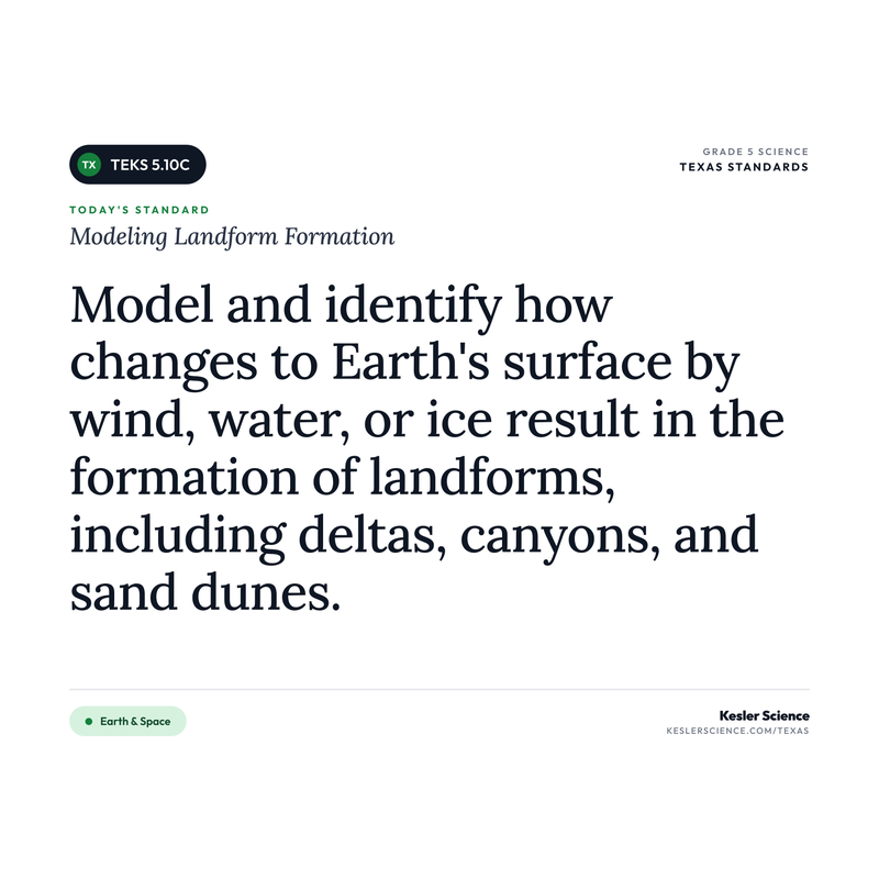
Modeling Landform Formation
"Model and identify how changes to Earth's surface by wind, water, or ice result in the formation of landforms, including deltas, canyons, and sand dunes."
💡 What This Standard Actually Means
"Model and identify". Students build physical models that show how three forces of nature reshape Earth's surface and end up creating specific landforms. The standard names the three agents of change: wind, water, and ice. The standard also names the three landforms students must identify: deltas (formed when a river deposits sediment where it meets the ocean), canyons (formed when water cuts deep grooves through rock over a long time), and sand dunes (formed when wind piles sand into hills in dry places). The job is to connect each landform to the agent that built it. Wind builds dunes. Water carves canyons and dumps deltas. Ice can carve valleys too. Modeling means kids actually build these in trays or boxes and watch the formation happen.
Earth's surface looks the way it does because nature has been shaping it for a very long time. Three big forces do most of the heavy lifting: wind, water, and ice. Each one moves dirt, sand, and rock around in different ways, and over thousands or millions of years, they build the landforms we see today.
Water is the most powerful sculptor in most parts of the world. A river running over the same path for millions of years can cut a deep canyon through solid rock. The Grand Canyon was made this way by the Colorado River. When that same river finally reaches the ocean, it slows down and drops the dirt and sand it was carrying, building a fan-shaped delta at the river's mouth. The Mississippi River dumps so much sediment into the Gulf of Mexico every year that the delta keeps growing. Wind moves smaller pieces, mostly sand and dust. In dry, sandy places, wind piles sand into sand dunes like the ones in the Sahara Desert or at White Sands National Park. Dunes can move and reshape themselves with every wind storm. Ice, in the form of glaciers, slowly grinds across the land, carving valleys and dropping huge amounts of rock and dirt as the glaciers melt.
The takeaway: every landform tells a story about which force built it. A deep canyon was carved by a river. A delta was built up by a river dropping its load. A sand dune was sculpted by the wind. Once kids can match the landform to the agent, they can read any landscape they fly over and explain how it got that way.
Stream tables are the gold standard for teaching this one, but they're expensive and a pain to clean up. The low-budget version I'd reach for is a plastic shoebox-sized container, a small mound of damp sand at one end, and a slow trickle of water from a measuring cup. Kids tilt the tray and pour the water in slowly. The water cuts a little canyon down the slope as it runs. At the bottom of the tray, where the water slows and pools, the sand piles up in a little fan: a delta. They've just built two landforms in three minutes. For sand dunes, switch over to a foil tray of dry sand and a big fan or a hairdryer on cool. Blow the air across the tray and you can watch dunes shift and pile up downwind. Twenty minutes of plastic shoeboxes does more than a week of textbook reading. Get them building.
⚠️ Misconceptions Your Students May Have
These are some of the most common misconceptions. Knowing what to look for can help you get ahead of them.
"Landforms have always looked the same"
Landforms are constantly changing. The Grand Canyon is still slowly getting deeper. The Mississippi Delta is still growing. Sand dunes shift with every windstorm. The changes are slow on a human timescale, so it looks like nothing is happening, but over hundreds, thousands, or millions of years, the changes add up to canyons, deltas, dunes, and even mountains.
"Wind only carries dust, not enough to make a landform"
Wind is one of the main builders of dry landscapes. In deserts and along coastlines, wind picks up sand and piles it into dunes that can be hundreds of feet tall. The sand dunes at White Sands National Park in New Mexico cover almost 275 square miles, all built by wind. Even small wind events move sand around. Over thousands of years, the sand really stacks up.
"Canyons and deltas form quickly"
Both take a really long time. The Grand Canyon was carved over millions of years by the Colorado River cutting deeper and deeper. The Mississippi Delta grows just by inches per year, but it's been growing for thousands of years, so it now covers thousands of square miles. The processes are slow but constant. Time is the secret ingredient in landform formation.
"All rivers form deltas"
Not every river forms a delta. A delta only forms when a river is carrying lots of sediment and the water slows down significantly when it meets a still body of water like an ocean or lake. Rivers that flow into rough seas or strong currents often don't form deltas because the ocean water carries the sediment away before it can pile up. The Mississippi forms a giant delta. Some smaller rivers don't form deltas at all.
📓 Teaching Resources for 5.10C
These resources are aligned to this standard.


100% Aligned Lessons for Every TEKS You Teach
Kesler Science Plus puts thousands of ready-to-teach lessons and activities in your hands, so you can boost engagement and get your planning time back. Trusted by schools and districts all over the great state of Texas.
🌎 Phenomenon Ideas for 5.10C
Use these real-world phenomena to anchor your lesson. Show students the phenomenon first, let them wonder, then build toward Modeling Landform Formation as the explanation.
The Grand Canyon Time Machine
A photograph of the Grand Canyon shows a mile-deep, ten-mile-wide gash in the Earth's surface. The Colorado River runs through the bottom, looking like a tiny silver thread compared to the giant canyon walls. The same little river, scaled to the size of the canyon, looks impossibly small. Yet scientists generally agree that this river has been carving the canyon for the past 5 to 6 million years (though some sections may be even older), one tiny scoop of sand at a time.
"How could a tiny-looking river create a canyon a mile deep and miles wide? What does this tell you about what slow, repeated processes can do over a very long time?"
The Growing Mississippi Delta
Aerial maps of the Mississippi Delta from 1850, 1950, and today show that the land at the mouth of the river has been growing outward into the Gulf of Mexico. The river dumps about 200 million tons of sediment into the Gulf every year, and most of it piles up where the river meets the sea. Cities and towns now sit on land that was open ocean a few thousand years ago. The river is still building new land every single day.
"Where does the dirt that builds the delta come from? Why does the river drop it specifically at the mouth, instead of carrying it all the way out to sea? Make a model with a tray, sand, and water to show how this works."
The Walking Dunes of White Sands
A time-lapse video shows the giant gypsum sand dunes at White Sands National Park slowly moving across the landscape over a period of years. Some of the dunes are over 60 feet tall. They migrate downwind a few feet every year as the wind picks up sand from the windward side and dumps it on the leeward side. A picnic spot from ten years ago might now be buried under several feet of sand. The dunes are alive, in a sense, sculpted minute by minute by the wind.
"How does wind move a giant sand dune? Why do dunes form in some places and not others? Build a model with a tray of sand and a fan to show how wind shapes the surface of a dune."
💡 Free Engagement Ideas for 5.10C
Stream Table Canyon and Delta
Each group gets a plastic shoebox-sized tray with a mound of damp sand piled at one end. They tilt the tray, pour a slow trickle of water from a measuring cup down the sand, and watch the water cut a "canyon" through the slope. At the bottom of the tray, the water slows and dumps the sand it was carrying, forming a "delta." They sketch the tray before and after and label the canyon and the delta. Best landform demo there is.
Sand Dune Wind Tray
Each group has a foil baking pan filled with a thin layer of dry sand and a small handheld fan or hairdryer (cool setting). They blow the wind from one end of the tray and watch sand pile up and form dunes downwind. They try different wind angles and speeds to see how the dunes change shape. They sketch the dunes that formed and write a sentence about which direction the wind was blowing.
Landform Match-Up Cards
Print cards showing photos of canyons, deltas, sand dunes, and a few extras (mountains, valleys carved by glaciers). Print another set of cards with the agents (water, wind, ice). Students match each landform to the agent that formed it, then write a sentence about each match explaining why. Quick five-minute warm-up that locks in the connections.
Texas Landform Map Hunt
Pull up a map of Texas and identify three landforms students can recognize: Palo Duro Canyon (water-carved), the Monahans Sandhills (wind-formed dunes), and the Mississippi Delta in southeast Louisiana (several hundred miles east of Texas). Students label each one on a printed map and write a sentence about which agent shaped it. Connects the standard to local geography.
🎯 What Approaches, Meets, and Masters Thinking Look Like
Here is what student thinking at each level looks like on this one task, so you know what to look for and how to move a student up.
A student builds a model in a shallow tray. She spreads a flat layer of dry sand across the bottom, then uses a straw to blow steady puffs of air across it from one end. After a minute, a small hill of sand has piled up. Make a labeled drawing of what the tray looks like, name the landform the model is forming, and explain how the moving air built it.
- A drawing that shows the flat sand at the start and the piled-up hill after blowing, not just one picture.
- The landform named correctly as a sand dune.
- The straw's air labeled as the wind (the agent of change in this model).
- An explanation that the moving air picked up sand grains and dropped them in one spot, piling them into a hill.
- A statement that wind, not water or ice, is the force building this landform.
- The idea that real dunes form the same way, just with real wind over a much longer time.
- That wind alone, moving lots of sand bit by bit, is enough to build a whole landform. That is the easiest place to slip.
The sand made a little hill. I think it is a sand dune. But the wind only blew a tiny bump because wind just carries dust around. Real dunes are way too big for wind to make. Something else like water probably helped pile up the big ones.
The landform is a sand dune. The moving air from the straw is the wind. The wind picked up the little sand grains and pushed them along, then dropped them in one spot. As more and more grains piled up, they made a hill. Wind is the force that built it, not water or ice. Real sand dunes in the desert form the same way, the real wind just blows for a really long time and makes them huge.
The landform is a sand dune. The wind from the straw picks up loose sand grains, carries them, and drops them where the air slows down. Over and over, that pile grows into a hill. The big idea is that wind builds a landform by moving lots of tiny loose pieces and dropping them all in the same place. Real desert dunes are just this same thing with real wind over thousands of years.
That is also how I can explain something I have seen myself. After a windy snowstorm, the snow gets piled up in a big drift against the fence, even where it barely snowed everywhere else. The wind moved the loose snow the same way the straw moved the sand and dropped it in one spot. It is the same rule: moving air piling up loose pieces. Snow drifts are basically dunes made of snow.
Every 5th-Grade Science TEKS on One Page
The color-coded, front-and-back cheat sheet I wish I'd had — every standard, organized by reporting category. Print it and reference it all year long. This will be your new favorite document!
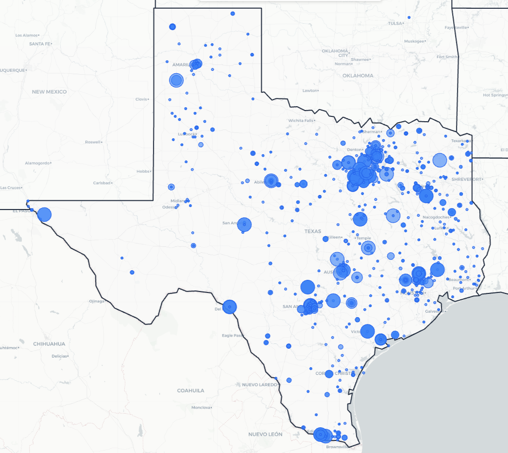
Trusted Across Texas
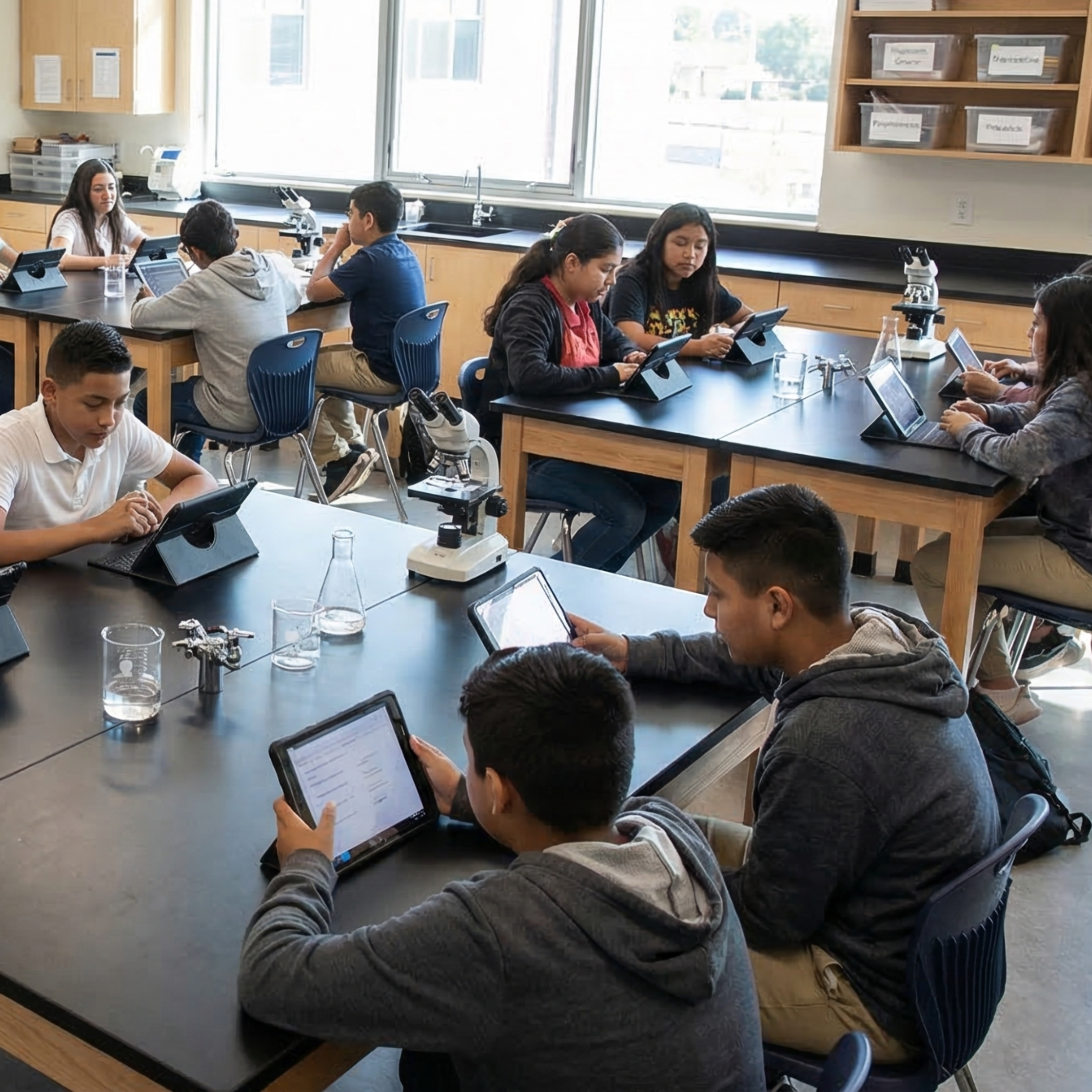
From the Rio Grande Valley to the Panhandle, Texas science teachers are using Kesler Science to save time and engage students.
Texas Schools and Districts
Love Kesler Science
What Teachers Are Saying
Give Your Science Teachers Everything They Need
School and district licenses give your teachers access to every resource they need, including station labs, inquiry labs, anchoring phenomena, presentations, escape rooms, and much more. One purchase covers the grade levels you need.
- PO-friendly. We accept purchase orders
- Volume discounts for 11+ teachers
- Complimentary Kesler Science Plus orientation for 4+ teachers
- Three free implementation PD sessions for departments of 11+
- Aligned to the 2024 TEKS standards
See It in Action
Book a walkthrough and we'll show you how Kesler Science fits your campus.
Book Demo CallNo pressure, no hard sell