Topographic Maps Lesson Plan – A Complete Science Lesson Using the 5E Method of Instruction
By the end of this comprehensive lesson about topographic maps, students will be able to interpret topographic maps and satellite views to identify land and erosional features and predict how these features may be reshaped by weathering and erosion. Each of our lessons is designed using the 5E method of instruction to ensure maximum comprehension by the students. This well-thought out unit does the heavy lifting, giving teachers easy-to-implement, highly engaging lesson plans.
This blog will walk you through each of the steps and activities from the Topographic Map 5E Lesson Plan.
ENGAGEMENT
Objective Introduction
At the beginning of the lesson, the class will do a Think-Pair-Share to discuss the objective.
Class Activity
- Ask students if they have visited areas of the country such as the Grand Canyon, Yellowstone, Crater Lake, or other national or state parks that have high or otherwise interesting elevations.
- Have them search online for a topographic map of a particular destination.
- Ask them if they see numbers on their map and ask what they think these numbers represent.
- Explain that the numbers represent elevation (the land's distance above sea level).
- Introduce the term contour line. Tell them a contour line is a line on a topographic map which connects different points of the same elevation.
- Draw an example of a hill on the board with a couple of contour lines.
Student Activity
- Give students contour maps and have them spend some time writing general observations.
- Write some of their responses on the board.
- Tell them about how, over the next few days, they'll be learning about topographic maps and how to determine and predict erosional features from looking at maps.
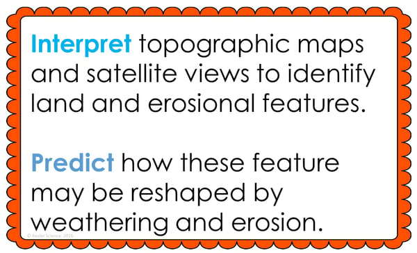
Afterwards, the teacher will help to clear any misconceptions their students have about topographic maps. A common but major misconception, for example, is that students may only think roadmaps can be used to determine elevations.
Estimated Class Time for the Engagement: 20-30 minutes
EXPLORATION
This student-centered station lab is set up so students can begin to explore topographic maps. With nine stations in total, you can introduce topography to your middle school students in a variety of ways! Four of these stations are considered input stations where students will learn new information about topographic maps, and four of the stations are output stations where students will be demonstrating their mastery of the lesson's material. A bonus station offers challenges for your early finishers and independent learners. You can read more about how I set up the station labs here.
Watch It!
At this station, students will be watching a short video explaining what topography is. Students will then answer questions related to the video and record their answers on their lab station sheet. For example: What is topography? Why are topographic maps useful? How does the slope change as the lines get closer together?
Read It!
This station will provide students with a one-page reading about topographic maps. Students will read about who uses the maps and how they help these people determine the steepness of the terrain they are working on. There are four follow-up questions that the students will answer to demonstrate their comprehension of the reading material.
Explore It!
Students will be working in pairs to better understand topographic maps. Students will be using pictures of Enchanted Rock to do so. Hopefully, some of your your students have been visited it before and seen the topographic map for that location. Students will then use the maps to interpret what the contour lines are telling us. Students will record their observations on their lab sheet.
Research It!
The research station will allow students to read information from a topographic map. Students will get to insert locations and see the elevation levels for that location. Encourage students to look up their address. Students will be instructed to complete a few tasks and record answers on their lab sheets.
Organize It!
The Organize It station allows your students to match the correct term with the definition. Once students have completed their organization, the teacher will come and check their understanding.
Illustrate It!
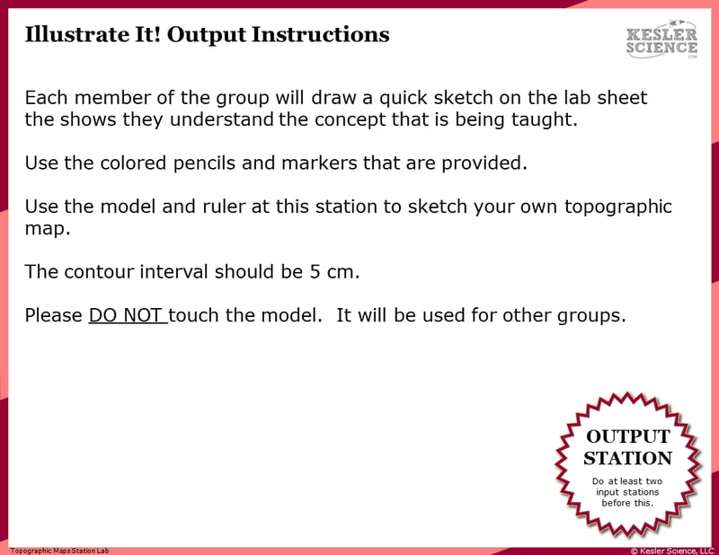
Your visual students will love this station. Students will use the model and ruler at this station to sketch their own topographical map. Contour intervals should be 5 cm.
Write It!
Students who can answer open-ended questions about the lab truly understand the concepts that are being taught. At this station, the students will be answering three task cards: Explain how to find the elevation change on a topographic map. Name two examples of someone that might use a topographic map? Explain how the steepness of a terrain will impact the appearance of contour lines on a topographic map.
Assess It!
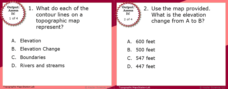
The Assess It station is where students will go to prove mastery over the concepts they learned in the lab. The questions are set up in a standardized format with multiple choice answers. Some questions include: What do each of the contour lines on a topographic map represent? Use the map provided, what is the elevation change from A to B? How can water change the appearance of a topographic map? Which side of the mountain has likely eroded away the most, causing it to be steeper?
Challenge It! - Bonus Station
Early finishers and advanced students will love the extension activities in this station. Four activity choices offer them ways to expand their learning through mini-games and mini-projects.
Estimated Class Time for the Exploration: One or two 45-minute class periods
EXPLANATION
The explanation activities will become much more engaging for your class once they’ve completed the exploration station lab. During the explanation piece of the lesson, the teacher will be clearing up any misconceptions their students may have about topographic maps with a variety of materials. These materials include on-level and modified versions of the interactive presentation (may be used individually or projected), anchor charts, and paper or digital interactive notebook activities. If you have students that need modified notes, the 5E lessons come equipped to help give every student access to the lesson.
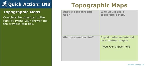
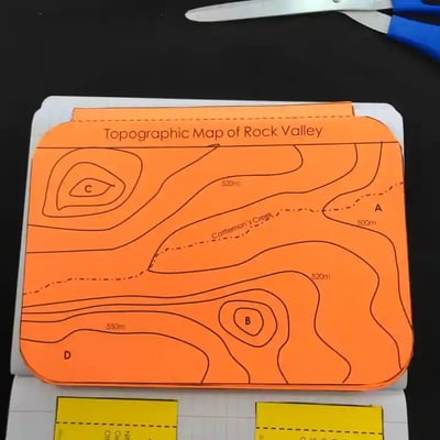
Interactive notebook samples: Above-left is a digital INB activity slide; above-right is an example of the paper INB activities.
The students will also be interacting with their journals using INB templates for topographic maps. Each INB activity is designed to help students compartmentalize information for a greater understanding of the concept. The topographic map INB templates allow students to focus their notes on understanding the how to read and interpret a topographical map.
Estimated Class Time for the Exploration: Two or three 45-minute class periods
ELABORATION
The elaboration section of the 5E method of instruction gives students choices that allow them to prove they’ve mastered the concepts behind the lesson. When students are given a choice, they’re much more enthusiastic and invested in the project than they are when their teachers choose their projects for them. There are a total of nine choices to demonstrate understanding of topographic maps. A separate set of choices that offer more teacher support are also available for students that need them. Rubrics guide students to doing their best work and assist in grading.

Estimated Class Time for the Elaboration: Two or three 45-minute class periods (can also be used as an at-home project)
EVALUATION
The final piece of the 5E model is to evaluate your students' comprehension. Included in every 5E lesson is a homework assignment, assessment, and modified assessment. Research has shown that homework needs to be meaningful and applicable to real-world activities in order to be effective. When possible, I like to give open-ended assessments to truly gauge the student’s comprehension.
Estimated Class Time for the Elaboration: One 45-minute class period
DOWNLOAD THE FULL LESSON NOW
Download Over $100 in FREE Resources
For Middle School Science
Simply create a login below and gain immediate access to a selection of our Kesler Science product line worth $100 - for FREE. There's a full version of every product type! You'll also join tens of thousands of middle school science teachers who receive timely tips and strategies straight to their inbox.


