Topographic Maps Inquiry Lab
Middle School Inquiry Lab on Topographic Maps
In this lab, students will learn the concepts of topographic maps by using play dough or clay to make models of topographic maps. They will also learn how to read contour lines to determine how erosional features such as waterfalls, rivers, and runoff have impacted the land over time.
Each inquiry lab will contain an essential question that will drive the lessons and make students think. For this lesson, the essential question is:
- What are topographic maps and how do they provide evidence for erosional changes on Earth’s surface?
BACKGROUND INFORMATION AND MATERIALS LIST:
Students will begin the lab by reading the essential question and background information. This can be done individually, as lab groups, or as a whole class. Personally, I would do it in lab groups and then do some whole class formative checks before digging into the lab.
Materials List:
- 1 can of play dough
- fishing line
- sheet of scratch paper
- ruler
PROCEDURE:
In this lab, students will get to be kids again and make a mountain formation out of a can of play dough. Of course, they have to remember
Students will have to create a side profile sketch rendition of their mountain and give as much detail as possible. Using a ruler, students will indicate height intervals that will help determine where they can take out cross sections of their mountains. As students take out sections, they will trace their sections creating their own topographic map.
CHECK FOR UNDERSTANDING:
At this point in the lab, students will be checked for understanding by answering questions about their findings. Here are a few that come with the lab:
- What are the lines on your map called?
- What information do they give to people looking at a map?
CONCLUSION
Students will go back to the essential question and write a CER (Claim, Evidence, Reasoning) to conclude the lab. Once completed, students will reflect back on their learning by answering the following questions:
- What is a topographic map, and what might it be used for?
- What do contour lines close together represent? Far apart?
- How might a topographic map help a scientist identify weathering and erosion occurrences on Earth’s surface?
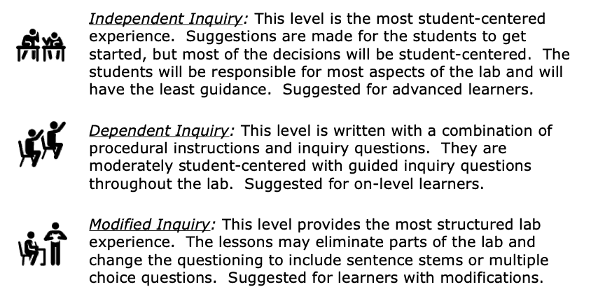
MODIFIED AND INDEPENDENT INQUIRY VERSIONS
All of the Kesler Science inquiry labs come with three different modification levels. Each lab is differentiated using the icons below.

Download Over $100 in FREE Resources
For Middle School Science
Simply create a login below and gain immediate access to a selection of our Kesler Science product line worth $100 - for FREE. There's a full version of every product type! You'll also join tens of thousands of middle school science teachers who receive timely tips and strategies straight to their inbox.


